Posts

Showing posts from June, 2021

Water Surveys

Image
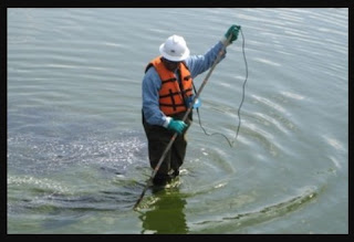
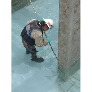
  For the wading survey mode the survey personnel wade in the water and systematically scan the submerged liner to locate any leaks. For this method, a water depth of between six and 30 inches (150 and 750 mm) is required. Temporary survey lanes are established across the bottom and are scanned with overlapping coverage. The liner field seams that can be located are double-checked. When detected, leaks are located to within one inch (25 mm) or less and immediately marked. The side slopes can be surveyed with deeper water using a long probe that is systematically scanned along the side slopes. Water Surveys 

Mining Leak Location

Image
  We’re an international company specializing in Electrical Leak Location Surveys of Geomembranes. We have 29 years of experience and deliver first-class surveys for our clients worldwide. Mining Leak Location

Water Surveys

Image
  If the water in the geomembrane lined pond, impoundment, or tank is too deep or the water in the pond is unsuitable for personnel to wade, then the towed probe survey mode is used. While standing on the top of the side slopes, survey personnel systematically pull the probe back and forth across the bottom of the pond along temporary survey lines. When detected, the distances to the leaks are immediately marked on the liner of the closer side slope. Water Surveys