Posts

Leak Location Services

Image
  Leak Location Services, Inc. is an international company specializing in Electrical Leak Location Surveys of Geomembranes. We have 29 years of experience and deliver first-class surveys for our clients worldwide. Contact our geomembrane experts today.

Leak Location Services

Image
  Leak Location Services, Inc. is an international company specializing in Electrical Leak Location Surveys of Geomembranes. We have 29 years of experience and deliver first-class surveys for our clients worldwide. Contact our geomembrane experts today. Leak Location Services

Soil Surveys

Image
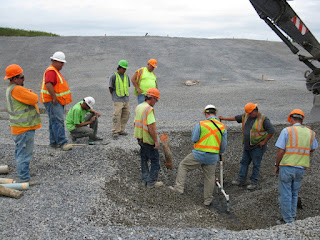
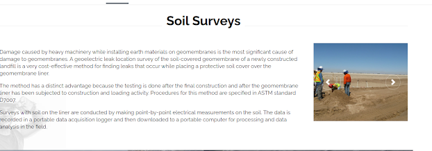
  Damage caused by heavy machinery while installing earth materials on geomembranes is the most significant cause of damage to geomembranes. A geoelectric leak location survey of the soil-covered geomembrane of a newly constructed landfill is a very cost-effective method for finding leaks that occur while placing a protective soil cover over the geomembrane liner. Surveys with soil on the liner are conducted by making point-by-point electrical measurements on the soil. The data is recorded in a portable data acquisition logger and then downloaded to a portable computer for processing and data analysis in the field.   Soil Surveys

Leak Location Services

Image
For the wading survey mode the survey personnel wade in the water and systematically scan the submerged liner to locate any leaks. For this method, a water depth of between six and 30 inches (150 and 750 mm) is required. Temporary survey lanes are established across the bottom and are scanned with overlapping coverage. The liner field seams that can be located are double-checked. When detected, leaks are located to within one inch (25 mm) or less and immediately marked. The side slopes can be surveyed with deeper water using a long probe that is systematically scanned along the side slopes.   Leak Location Services
Leak Location Services

Image
  For the wading survey mode the survey personnel wade in the water and systematically scan the submerged liner to locate any leaks. For this method, a water depth of between six and 30 inches (150 and 750 mm) is required. Temporary survey lanes are established across the bottom and are scanned with overlapping coverage. The liner field seams that can be located are double-checked. When detected, leaks are located to within one inch (25 mm) or less and immediately marked. The side slopes can be surveyed with deeper water using a long probe that is systematically scanned along the side slopes.

Bare Liner Surveys

Image
  For the wading survey mode the survey personnel wade in the water and systematically scan the submerged liner to locate any leaks. For this method, a water depth of between six and 30 inches (150 and 750 mm) is required. Temporary survey lanes are established across the bottom and are scanned with overlapping coverage. The liner field seams that can be located are double-checked. When detected, leaks are located to within one inch (25 mm) or less and immediately marked. The side slopes can be surveyed with deeper water using a long probe that is systematically scanned along the side slopes.

Soil Surveys

Image
  For the wading survey mode the survey personnel wade in the water and systematically scan the submerged liner to locate any leaks. For this method, a water depth of between six and 30 inches (150 and 750 mm) is required. Temporary survey lanes are established across the bottom and are scanned with overlapping coverage. The liner field seams that can be located are double-checked. When detected, leaks are located to within one inch (25 mm) or less and immediately marked. The side slopes can be surveyed with deeper water using a long probe that is systematically scanned along the side slopes.